Module 6 - Working with Rasters

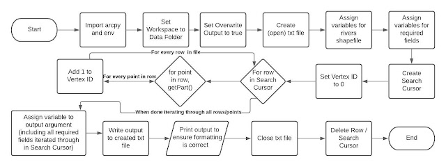
For the final laboratory assignment of this course, I created a comprehensive raster image, consisting of five other raster images I had curated with specific conditions. The flowchart below demonstrates my steps for accomplishing this task, including checking-in/out the spatial analyst module, using the RemapValue, Raster, Slope, and Aspect functions, and saving my final raster image. These were all relatively new concepts for the course and I enjoyed using them to accomplish the goal of this assignment. My script output in the IDE included the print statements explaining what each step involved and the final raster matched the one included in the lab instructions, verifying the script ran successfully. I had the most difficulty completing step 3e of the lab. This step involved slope and aspect calculations using map algebra. I struggled with naming all used variables in previous code and then formatting the syntax so that the code would run successfully. After consulting with va...


